
20250220175955.png)
Lot n° 48
Estimation :
250 - 300
EUR
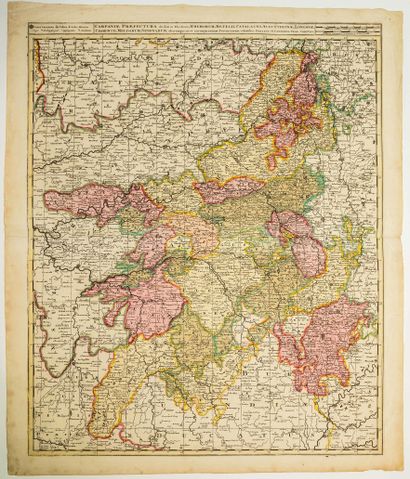
17th century map of the Government of CHAMPAGNE, by Gérard a - Lot 48
17th century map of the Government of CHAMPAGNE, by Gérard and Léonard VALK, Amsterdam (c. 1705) "Campaniæ præfectura divisum in Electiones Rhemorum, Retelii, Catalauni, Augustibonæ, Longonæ, Chamontii, Meldarum, Senonarum aliarumque, ut et circumjacentium Provinciarum" (54 x 64 cm) Condition B+.
My orders
Sale information
Sales conditions
Return to catalogue